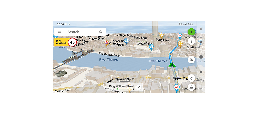
Real-time information on traffic jams for a map coverage area.
Navitel.Events
Road accidents, road works, speed cameras and other information added to a map by users.
3D-Cartography
Three dimension maps showing structure and height of buildings.
3D-Multi-level interchanges
Display of multi-level transport interchanges in 3D-mode.
Road lanes
Calculation of a route taking into account multilane roads and visual prompts while moving along the route.
Multilanguage system
Support of the interface and voice prompts in several languages.
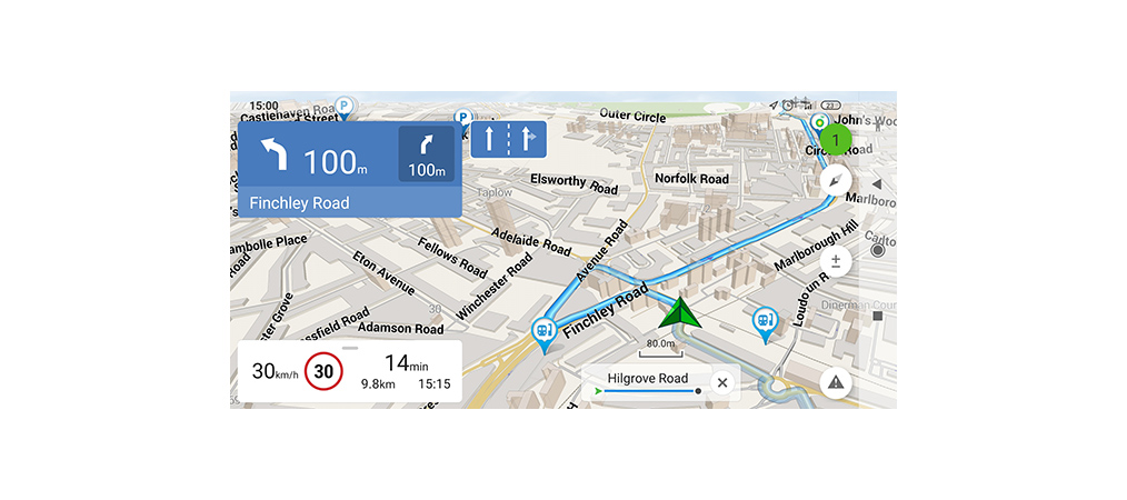
Voice prompts
Voice guide while moving along a route, warning on battery charge and connection to satellites.
Purchase through programme menu
Purchase of new map packages and update of the purchased ones through "My Navitel" menu.
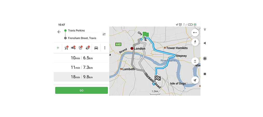
Quick routing
Instantaneous calculation and building of a route of any length and complexity.
Unlimited number of points for routing
Easy routing with unlimited number of itinerary points.
Adjustable interface
Adjustable programme interface and map display modes.
Multi-touch
Quick access to map scaling and rotation functions by multi-touch input.
Navitel Navigator. Armenia
The NAVITEL® navigation map "Armenia" is notable for the inherently high level of details. The map contains the up-to-date data on infrastructure of settlements and a convenient search tool that allows searching for specific addresses, nearest POIs, coordinates, etc.
For the sake of efficient route planning, the street network includes streets and roads with due account to road directions, interchanges, and other important road information.
The NAVITEL® map includes an extended POI database (gas stations, ATMs, restaurants, etc) together with a profound SPEEDCAM database that allows foreseeing different speed controlling means.
A license key may be registered only for a single smartphone, tablet or PND. For an IPHONE or IPAD map purchase is available only from the main menu of the “Navitel Navigator” program (Main menu > My Navitel > Purchase maps).
Requirements
Navigation system Navitel Navigator 9.13 or later
Android: 4.4 or higher
Supported interface: touch screen.
RAM: not less than 50 MB.
Free space for program installation depends on technical characteristics of the device.
Cookie settings: To help you find what you're looking for quickly on our site, save you a lot of clicking and avoid seeing ads for things you're not interested in, we need your consent to process cookies, which are small files that are stored in your browser. We use cookies to recognise you on our site and display them so that everything works properly and according to your preferences. You can find more information in the cookies policy.